
India Map – 1600s
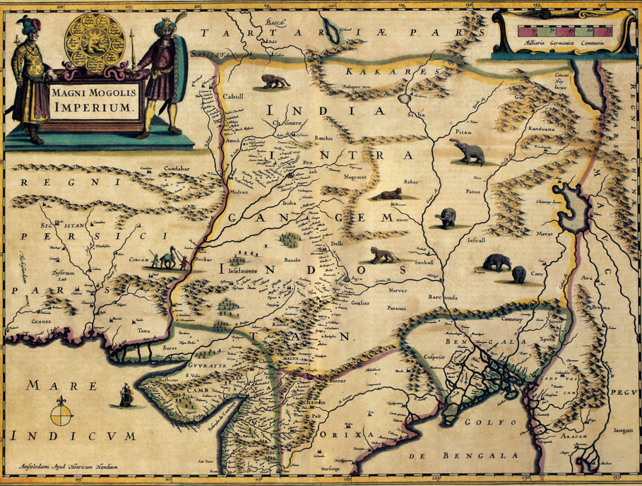
The first-ever British attempt to map the Mughal empire was by Arctic explorer and surveyor William Baffin in 1619. England’s first ambassador to Mughal India, Sir Thomas Roe, visited Jahangir’s court and managed to gather substantial geographical information that he then passed on to Baffin. The latter then accompanied Roe on his return journey from India to Persia, compiled the data collected and produced an educated impression. Known as Sir Thomas Roe’s Map, it influenced cartographers for over a century, becoming the basis for innumerable future maps of India.
Flemish-born engraver, cartographer and publisher Hendrik Hondius created this particular map of the Mughal Empire, titled Magni Mogolis Imperium, in 1639 using the Baffin map to draw his initial plans, and then expanding it based on other sources, such as travellers’ accounts. The extent of the Mughal domain is clearly shown, bordering the Persian Empire in the west across to Myanmar in the east. Important cities that fell on crucial trade routes, like Delhi, Agra, Gualiar (Gwalior) and Soret (Surat), are clearly demarcated.
The title cartouche at the top left is particularly interesting — two noblemen dressed in Mughal-esque costumes stand on either side of the Mughal insignia, which includes the sun fronted by a lion, and surrounded by names of the kings and their Timurid ancestors. The names end at Jahangir, who was the ruler at the time of Roe’s visit. But our favourites are the whimsical drawings all over the map of animals native to India, like the lion, elephant and tiger.
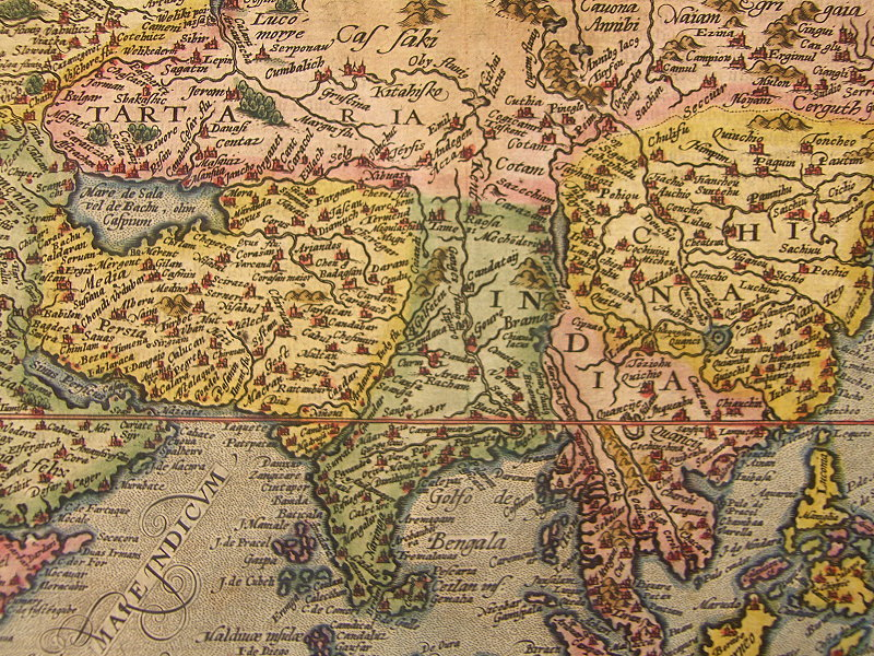
Eastern Asia, in a miniature atlas map by Matthias Quad, from
‘Geographisch Handtbuch’ (Cologne, Johann Bussemacher, 1600), with modern hand coloring
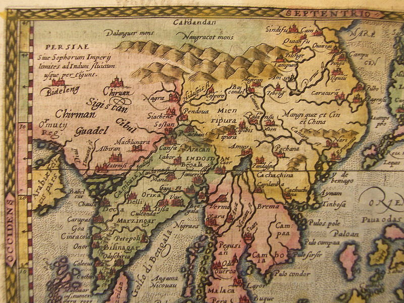
Ancient map of Persia and North Western India (circa 1676)
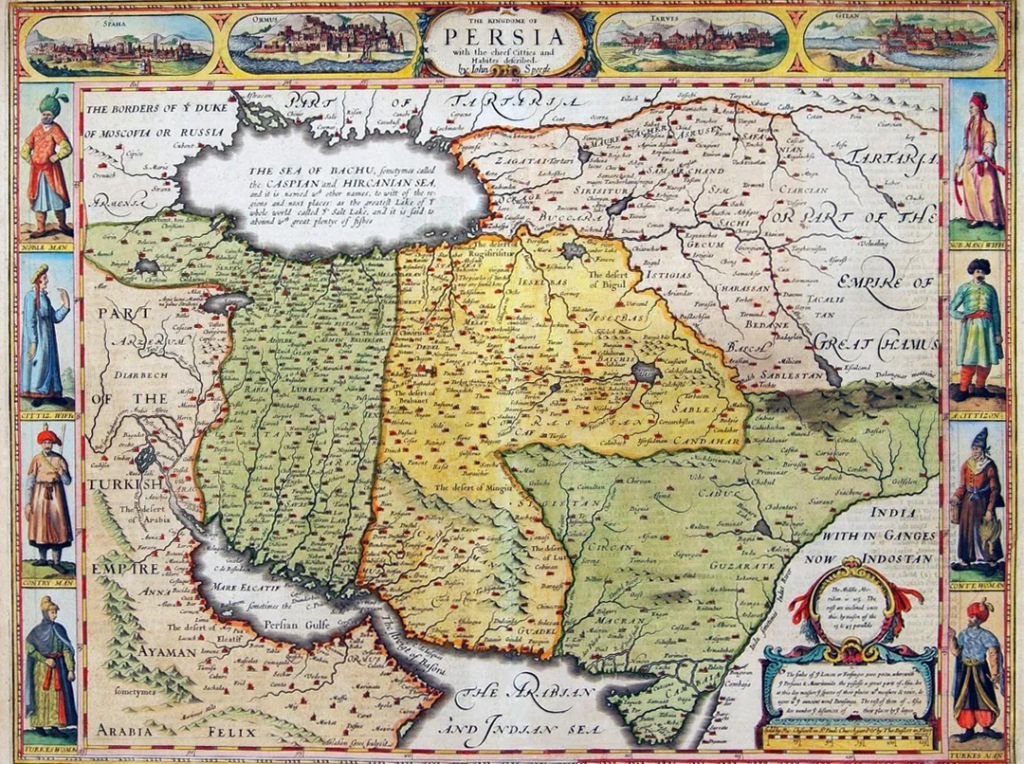
This beautifully engraved map, titled“The Kingdome of Persia with the Cheef Citties and Habites Described,” originated in England and was created by the renowned cartographer John Speed (1552-1629) for his world atlas A Prospect of the Most Famous Parts of the World, first published in 1627. The map depicts the Safavid Persian Empire at its height, extending from Mesopotamia and the Persian Gulf to Central Asia and the borders of Mughal India, while showcasing important cities, trade routes, deserts, rivers, and regional divisions. Richly decorated in the distinctive carte-à-figures style, it features panoramic city views across the top and figures in regional dress along the sides, reflecting both European curiosity about distant cultures and the growing commercial and diplomatic importance of Persia in the seventeenth century. Although some geographical details reflect the limited knowledge of the era, the map remains one of the most celebrated early English representations of Persia and serves as an important historical record of how European scholars and mapmakers understood the Near East during the age of exploration and global trade.
Map of Asia 1630
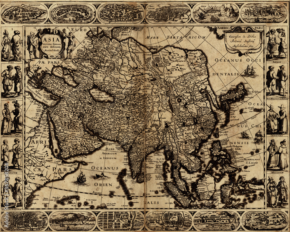
This map is a classic 17th-century European depiction of Asia, titled “Asia recens summa cura delineata” (“Asia newly and carefully delineated”), and was produced by the Dutch cartographer Jodocus Hondius the Younger (1593-1629), one of the leading figures of the Golden Age of Dutch cartography. The map presents the entire Asian continent from the eastern Mediterranean and Arabia to China, Japan, and the islands of Southeast Asia, reflecting European geographical knowledge during the Age of Exploration. Richly ornamented in the popular carte-à-figures style, it is framed by detailed city views along the top and bottom borders and by figures in regional dress along the sides, combining cartography with ethnographic and cultural imagery. Although some coastlines, political boundaries, and interior regions contain inaccuracies typical of the period, the map illustrates the growing European interest in Asian trade, diplomacy, religion, and exploration. As both a geographic document and a work of art, it captures how early seventeenth-century Europeans envisioned Asia as a vast, diverse, and interconnected continent at the center of global commerce and cultural exchange, making it one of the most influential decorative maps of its era.
Old map of Indian Ocean – From an 1656 Atlas of Geography from P. du Val – France
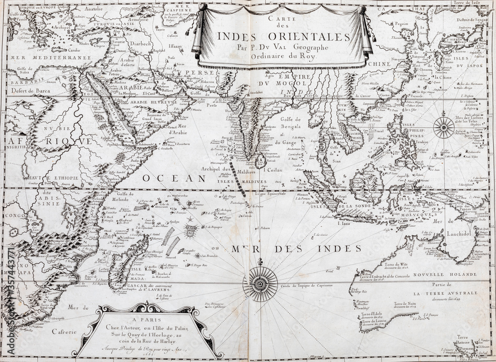
This map, titled “Carte des Indes Orientales” (Map of the East Indies), is a French cartographic work from the late 17th or early 18th century, attributed to the prominent geographer Pierre Duval (1619-1683), who served as Géographe Ordinaire du Roi (Royal Geographer) to the French crown. Centered on the Indian Ocean world, the map spans eastern Africa, Arabia, Persia, the Mughal Empire, Southeast Asia, the Indonesian archipelago, and portions of Australia then known as Nouvelle Hollande (New Holland). Its geographical focus reflects the growing importance of maritime trade routes linking Europe with the spice-producing regions of Asia, highlighting major ports, islands, sea passages, and commercial centers used by European trading powers. Unlike the highly decorative Dutch maps of the same era, this French map emphasizes navigational utility and geographic knowledge, incorporating compass roses, sea routes, and updated coastal outlines. The map is an important artifact of the Age of Exploration, illustrating how French cartographers viewed the interconnected Indian Ocean basin as the center of global commerce, where European, Middle Eastern, African, Indian, and Southeast Asian networks converged in an increasingly interconnected world.
Map of South and South East Asia
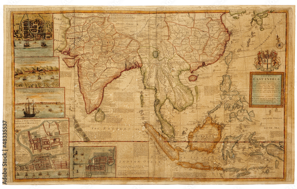
This map is Herman Moll’s “A Map of the East-Indies and the Adjacent Countries,” first published in London around 1715-1717, during the height of European commercial expansion in Asia. Produced for the directors of the British East India Company, the map extends from Persia and Arabia across the Indian subcontinent to Southeast Asia, China, the Philippines, and the Indonesian archipelago, illustrating the extensive network of European trading settlements, factories, and territories in the region. Distinctive inset views of major commercial centers such as Goa, Surat, Madras (Chennai), Batavia (Jakarta), and Bantam emphasize the importance of maritime trade and colonial influence in the Indian Ocean world. Combining detailed geographic information with extensive historical and commercial annotations, the map reflects the growing economic rivalry among England, Holland, Portugal, France, Denmark, and Spain for access to Asia’s lucrative spice, textile, and luxury-goods markets. Today, it is regarded as one of the most important English maps of the East Indies, offering a remarkable snapshot of early eighteenth-century global trade, navigation, and imperial ambition.
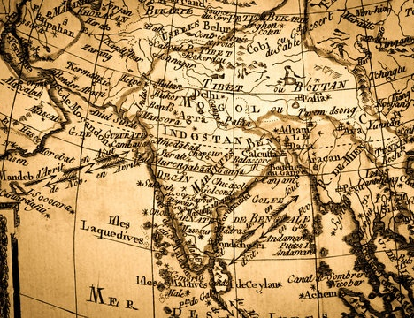
This 1624 map is showing the northern part of the Indian Ocean. With three insets: The Mediterranean Sea, showing the errors of Ulysses; a circular inset “Annonis Periplus” at top left which represents the Northwest coast of Africa and a second circular inset of the north pole at top right. The inset Hyperborei has been added, as Ortelius puts it “for better beautifying or proportioning of this map”, and to remind the reader that in spite of all their exertions, a passage to the Far East via the North Pole has not yet been found by the English or the Dutch.