
India Map – 1500s
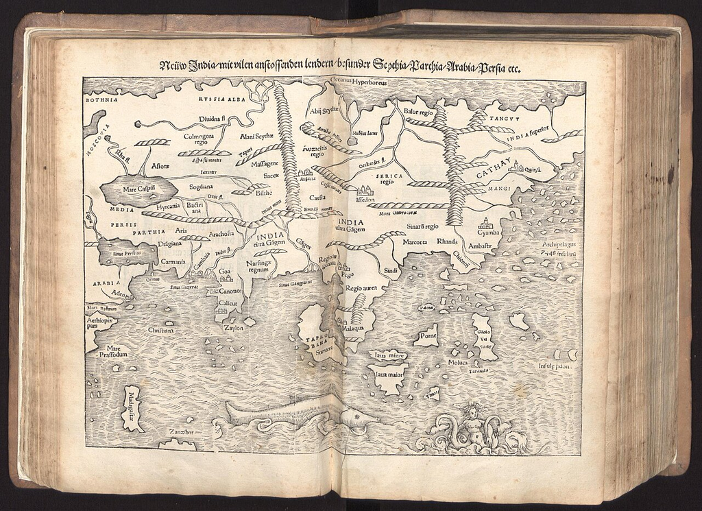
This is a fascinating early 16th-century map of India and Southeast Asia, most likely derived from Martin Waldseemüller’s Carta Marina (1516) or one of the early German cosmographies that incorporated Portuguese discoveries after Vasco da Gama’s voyage to India. The German title at the top, “New India with all adjacent lands…” (Neüw India mit vilen anstossenden lendern), suggests it was intended to present newly acquired European knowledge of Asia following the opening of the sea route around Africa.
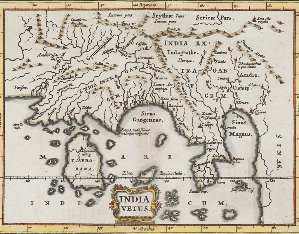
One of the earliest modern cartographers of the world, Philipp Clüver (aka Cluverius) was born in Danzig in 1580, and is widely regarded as the founder of historical geography. He is the creator of this stunning — if almost unrecognisable — map of India. Titled India Vetus, meaning ‘Old India’, this map was part of a larger series called the Introductio in Universam Geographiam (published in Amsterdam in 1641), Clüver’s most important work of six volumes. It was loosely based on Ptolemy’s map of the world, and contained descriptions and engraved maps of all countries, with a focus on human and historical considerations.
The map features a heavily truncated view of the Indian Peninsula, with the Bay of Bengal being termed the Sinus Gangeticus. The island of Sri Lanka is incorrectly placed on the left side, and is labelled as Taprobana. This is believed to be an interpretation of the word Tamraparni (or Tambapanni, meaning copper-coloured) by the ancient Greeks. Taprobana became the name that Sri Lanka was known by, and was subsequently used in many of the oldest maps of the world.
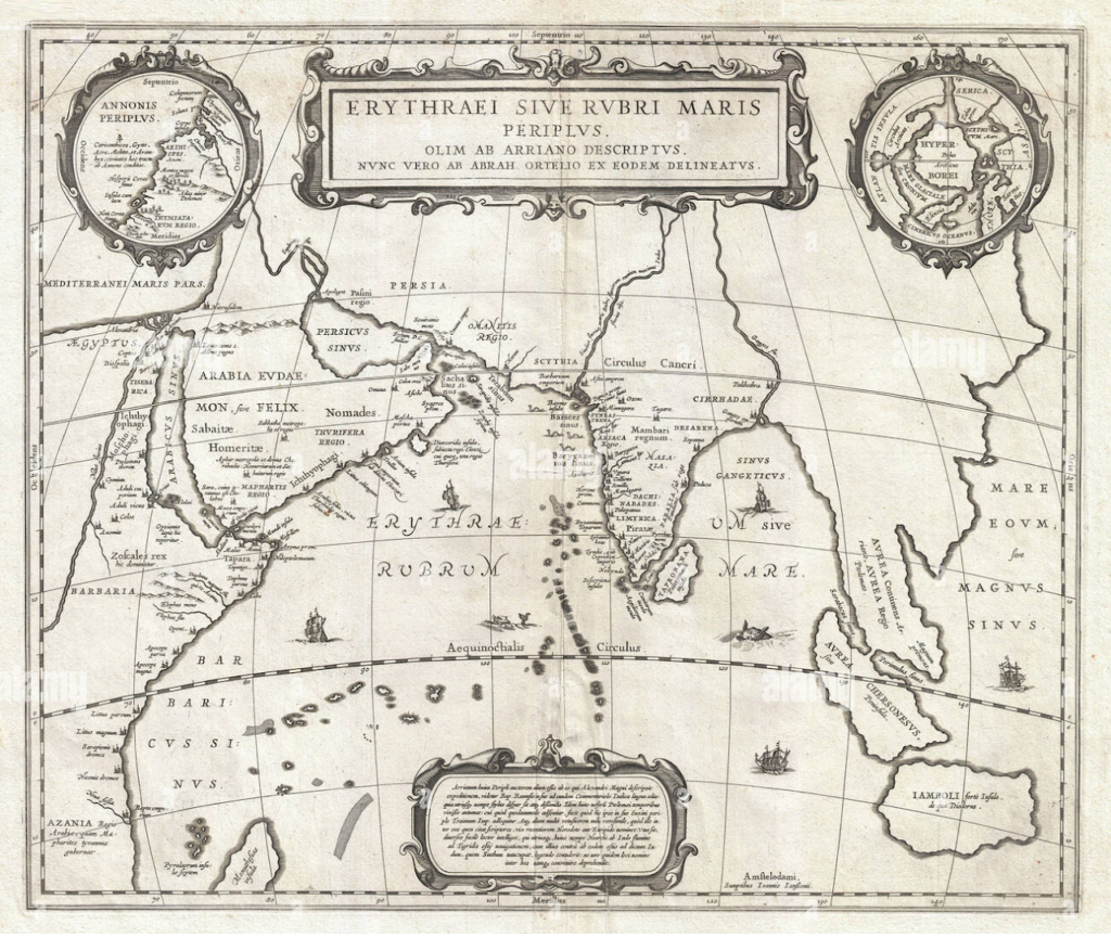
This map edition is of Abraham Ortelius’s Erythraei sive Rubri Maris Periplus (“Voyage of the Erythraean or Red Sea”), originally compiled in the late sixteenth century (First publication: 1597 in the Parergon atlas) and later republished by Dutch mapmakers such as Jan Jansson in the seventeenth century. It is a historical rather than contemporary map, reconstructing the geography of the Red Sea, Arabian Sea, Persian Gulf, and Indian Ocean from classical sources, particularly the ancient Periplus of the Erythraean Sea, a first-century guide to maritime trade between the Roman world, Arabia, East Africa, Persia, and India. The map depicts ancient ports, kingdoms, and trading centers stretching from Roman Egypt and the Horn of Africa to the western coast of India and Sri Lanka, highlighting the commercial networks that linked the Mediterranean world with the riches of the East. Decorative cartouches and inset maps reinforce the Renaissance fascination with classical scholarship, while the sparse yet elegant presentation reflects an effort to visualize antiquity through the lens of emerging scientific cartography. As one of the most influential historical maps of the Indian Ocean basin, it illustrates how European scholars sought to recover and interpret the geography of ancient trade routes that connected Africa, Arabia, India, and Southeast Asia long before the Age of Exploration.
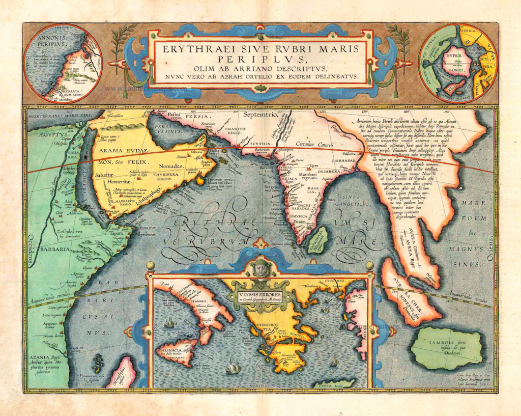
This map, titled“Erythraei sive Rubri Maris Periplus” (“Voyage Around the Erythraean or Red Sea”), was created by the celebrated Flemish cartographer Abraham Ortelius (1527-1598) and first published in his Parergon, a historical atlas accompanying the famous Theatrum Orbis Terrarum, the world’s first modern atlas. Unlike contemporary maps based solely on current geography, this work reconstructs the ancient world described in classical Greco-Roman sources, particularly the Periplus of the Erythraean Sea, a first-century mariner’s guide to the trade routes of the Red Sea, Arabian Sea, Persian Gulf, and Indian Ocean. The map encompasses eastern Africa, Arabia, Persia, India, and Southeast Asia, illustrating the maritime networks that linked the Roman Empire with the wealthy markets of Arabia and the Indian subcontinent. Decorative cartouches, classical references, and inset maps emphasize Ortelius’s goal of merging Renaissance scholarship with cartography, while the depiction of ancient place names and trading centers reflects Europe’s renewed fascination with classical geography and long-distance commerce. As one of the earliest historical maps of the Indian Ocean world, it stands as a remarkable testament to how sixteenth-century scholars sought to visualize and understand the interconnected trading routes of antiquity.