
India Map – 1400s
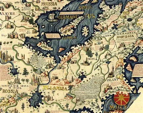
The Fra Mauro World Map, created around 1450 by the Venetian monk and cartographer Fra Mauro, is widely regarded as the finest and most accurate world map of the late medieval period. Produced in Venice at a time when the city was a major center of global commerce, the map incorporates knowledge gathered from merchants, travelers, Arab geographers, and explorers, including accounts from travelers to India and the Indian Ocean world. Unlike many earlier medieval maps, Fra Mauro’s work emphasizes practical geography over religious symbolism and presents a remarkably detailed depiction of India, Sri Lanka (Taprobana), the Arabian Sea, and the Indian Ocean trade routes, highlighting the region’s importance in international commerce. The map is notable for suggesting that Africa could be circumnavigated decades before Portuguese explorers proved this by sea, and it reflects a sophisticated understanding of Asian geography derived from contemporary travel reports. Featuring more than 3,000 inscriptions and extensive commentary, the map represents a crucial transition between medieval and Renaissance cartography and remains one of the most important geographical documents produced before the European Age of Discovery.
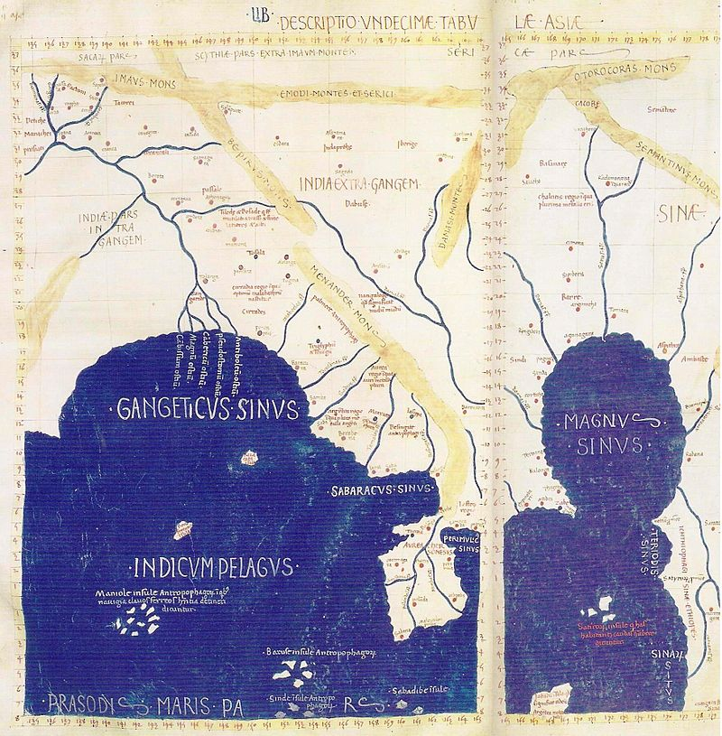
This map is Ptolemy’s Eleventh Map of Asia (Undecima Tabula Asiae), based on the Geographia of the Alexandrian geographer Claudius Ptolemy, originally compiled around 150 CE. Although the geographic information derives from the Roman world of the 2nd century, the surviving maps were reconstructed by Byzantine scholars in the late 13th century and subsequently published in numerous Renaissance editions from the late 15th century onward. The map depicts India Extra Gangem (“India Beyond the Ganges”), encompassing present-day Myanmar, Thailand, Cambodia, Vietnam, and parts of southern China, alongside India Intra Gangem (“India Within the Ganges”), representing the Indian subcontinent. Prominent features include the Gangetic Gulf (Bay of Bengal), the Magnus Sinus (Great Gulf), and the land of the Sinae, one of the earliest classical references to China. While the coastlines and proportions are heavily distorted by modern standards, the map reflects the geographical knowledge acquired through ancient trade networks linking the Mediterranean world with India and Southeast Asia. Its use of a coordinate grid, derived from Ptolemy’s pioneering system of latitude and longitude, made it one of the most influential cartographic works in history and a foundation for Renaissance mapmaking.
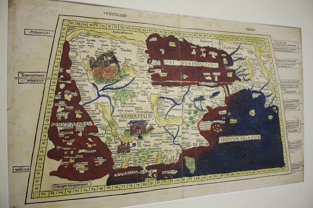
This map is Ptolemy’s Sixth Map of Asia (Sexta Asiae Tabula), one of the regional maps derived from the Geographia of Claudius Ptolemy, the Greek geographer who worked in Alexandria, Roman Egypt, around 150 CE. The version shown is likely from a Renaissance printed edition of Geographia published between 1477 and the early 1500s, when Ptolemy’s maps were rediscovered and became the foundation of European cartography.
From an Indian perspective, this map is particularly important because it focuses on the lands immediately west of the Indian subcontinent while highlighting the maritime routes that connected India to the ancient world. The map depicts Arabia Felix (southern Arabia), the Persian Gulf (Sinus Persicus), the Indian Ocean (Indicum Pelagus), Carmania, Gedrosia, and other regions that formed the overland and maritime approaches to India. India’s western frontier appears at the eastern edge of the map, reflecting how Greco-Roman geographers viewed India as the eastern limit of the known world.
Historically, the map illustrates the commercial network that linked the Roman Empire with India through Red Sea and Persian Gulf trade routes. Roman merchants sailed to Indian ports to obtain spices, pepper, gemstones, ivory, textiles, and other luxury goods. The prominence given to the Indian Ocean and adjacent coastal regions demonstrates the significance of maritime commerce centuries before the European Age of Exploration. Although the geography contains inaccuracies by modern standards, the map represents one of the earliest systematic attempts to locate places using coordinates of latitude and longitude, an innovation that profoundly influenced Renaissance mapmaking and later global cartography.